Join us in the wild! Visit Woodlands Conservancy’s restoration prESERVE and enjoy a hike in one of the region’s last stands of bottomland hardwood forest.
DIRECTIONS TO WOODLANDS CONSERVANCY
- Take the Crescent City Connection to the Westbank
- Take the General DeGaulle East exit (9B)
- Merge onto General DeGaulle and travel 2.9 miles, continuing over the Intracoastal Canal
- Enter the traffic circle at the end of the bridge ramp and exit left to go under the bridge
- Drive 0.6 miles on Highway 406/Woodland Hwy to the caution light
- Turn left at the caution light onto F. Edward Hebert Blvd
- Continue 0.6 Miles
- The entrance is on the left
- Drive on the dirt road along the canal to the parking area at the trailhead
WOODLANDS CONSERVANCY TRAILS
2.2 MI
OUT & BACK
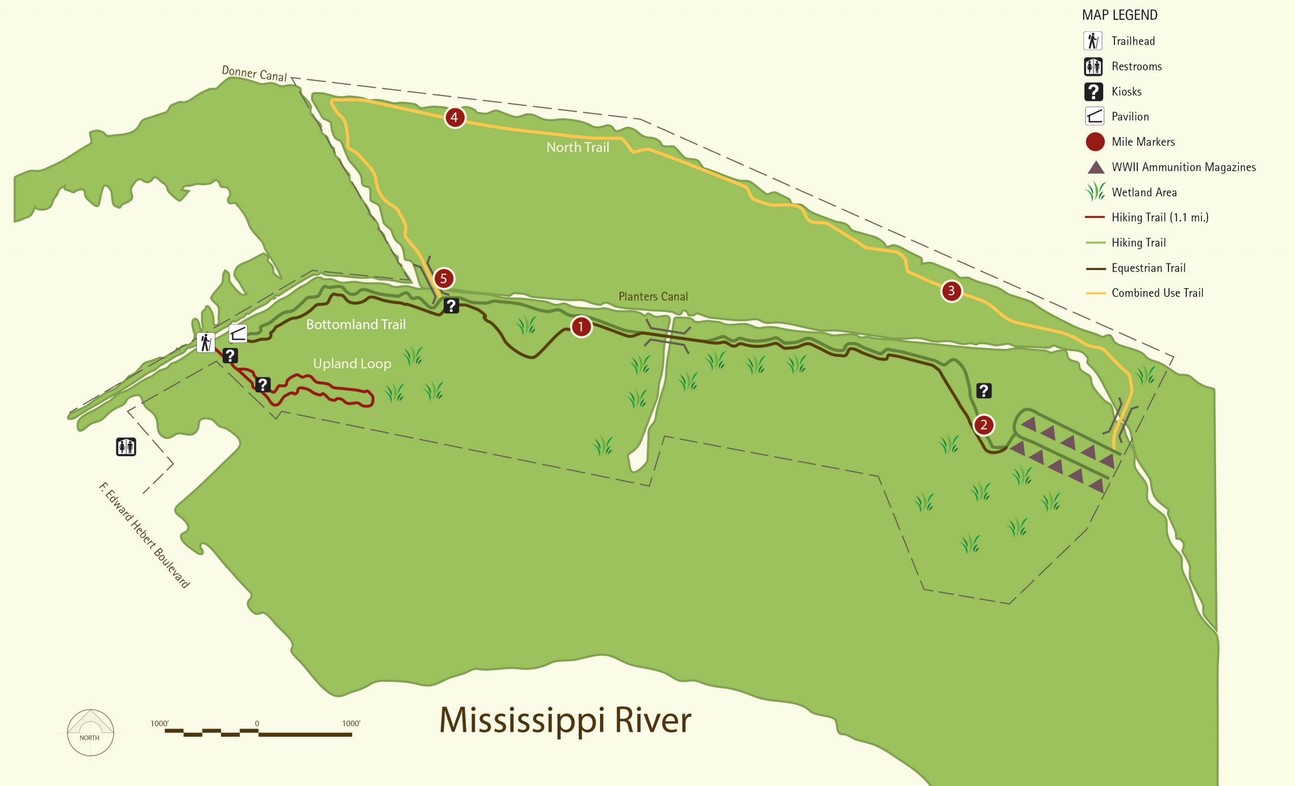
The Bottomland Trail is a set of parallel trails (one hiking and one equestrian). The trails come together to share water-crossings.
They follow along the spoil bank for 2.2 miles, dip southerly to the NAD loop containing 10 WWII ammunition magazines.
2 MI
OUT & BACK
Near the end of the NAD loop trail, the North Trail crosses a short bridge and goes north towards the Donner Canal levee. Near the property’s north-eastern border, the trail splits with both the hiking trail and equestrian trail parallel to each other.
The trails run approximately 2 miles parallel to the Donner Canal levee before turning southerly along an intersecting canal that takes you back to the LRT Bridge, 1/2 mile from the trailhead.
1.1 MI
LOOP
The Upland Trail is a 1.1 mile loop hiking trail. It begins at the trailhead and follows along a ridge next to a drainage canal, then heads northeast into the forest before circling back past a cleared “Meadow” and returns to the trailhead.